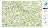
1979 Map of Appomattox
USGS Topo · Published 1982About this map
Appomattox Court House National Historical Park and the surrounding Southside Virginia countryside appear here in a period of late-twentieth-century stability. The landscape is defined by its deep connections to the Civil War, preserved at Saylers Creek Battlefield State Park and across the woodlands of the Appomattox-Buckingham State Forest. The regional infrastructure relies on a network of small settlements and transportation corridors, including the Norfolk and Western and Southern railroads which connect towns like Farmville, Blackstone, and Crewe.
Find a feature on this map
73 named features on this map. Tap any name to fly to it.
Don’t see what you’re looking for? This feature index may not catch every label — zoom into the map to look around manually.
Map Details
Editions of this 1979 Appomattox Map
This is the sole edition of this map. No revisions or reprints were ever made.
Other maps of this area

1890 · Goochland
USGS Topo · 1:125,000

1891 · Palmyra
USGS Topo · 1:125,000

1891 · Farmville
USGS Topo · 1:125,000

1892 · Lynchburg
USGS Topo · 1:125,000

1892 · Buckingham
USGS Topo · 1:125,000

1892 · Appomattox
USGS Topo · 1:125,000

1892 · Goochland
USGS Topo · 1:125,000

1893 · Farmville
USGS Topo · 1:125,000

1894 · Lexington
USGS Topo · 1:125,000

1895 · Palmyra
USGS Topo · 1:125,000