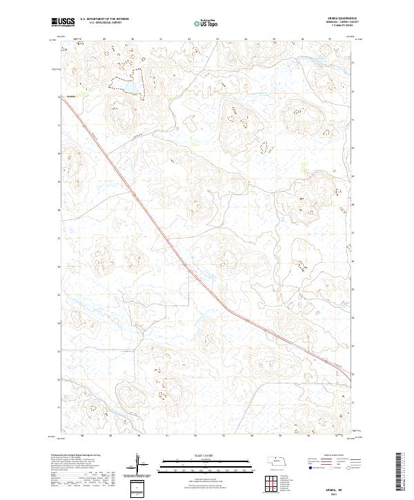
2021 Map of Arabia
USGS Topo · Published 2021About this map
The small settlement of Arabia sits in the Nebraska Sandhills, a landscape defined by its complex hydrology and early transportation routes. Cutting diagonally across the quadrangle is the Cowboy Trl, tracing the path of a former rail corridor that once served the remote ranching communities of Cherry County. This modern survey reflects the area's continued reliance on managed water systems, evidenced by the Ainsworth Canal in the south and the O'Kief Reservoir in the northeast corner. The natural drainage of the region is characterized by seasonal and perennial streams like Evergreen Cr and S Fork Fairfield Cr, which weave through the dune topography. Local transit is largely confined to the diagonal trail and Fairfield Rd, illustrating the sparse, functional road network required to navigate this portion of the Great Plains.
Find a feature on this map
11 named features on this map. Tap any name to fly to it.
Don’t see what you’re looking for? This feature index may not catch every label — zoom into the map to look around manually.
Map Details
Editions of this 2021 Arabia Map
This is the sole edition of this map. No revisions or reprints were ever made.
Other maps of this area

1950 · Norden
USGS Topo · 1:62,500

1950 · Sparks
USGS Topo · 1:62,500

1950 · Wood Lake
USGS Topo · 1:62,500

1950 · Arabia
USGS Topo · 1:62,500

1952 · Norden
USGS Topo · 1:62,500

1957 · Valentine
USGS Topo · 1:250,000

1959 · Valentine
USGS Topo · 1:250,000
1983 · Muleshoe Creek
USGS Topo · 1:24,000
1983 · Thatcher
USGS Topo · 1:24,000
1983 · Sparks SE
USGS Topo · 1:24,000