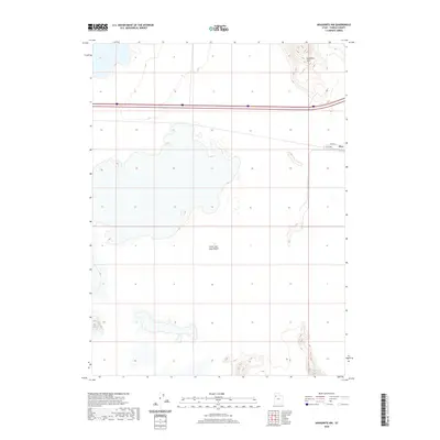
2020 Map of Aragonite NW
USGS Topo · Published 2020About this map
The Great Salt Lake Desert dominates this Tooele County landscape, where the flat, expansive terrain of the salt flats meets the elevated rises of the Grayback Hills in the northeast. This 2020 survey illustrates the stark intersection of a challenging natural environment and modern logistics, centered around the settlement of Clive. The area is defined by its isolation and specialized infrastructure, including the Clive Complex Rd, Clive Rd, and Clive Way, which serve the remote industrial facilities located here. Cutting through the northern portion of the quadrangle, Interstate 80 provides the primary transit artery across the basin, linking this austere desert reach to the wider regional network while passing just north of the salt-crusted lowlands.
Find a feature on this map
7 named features on this map. Tap any name to fly to it.
Don’t see what you’re looking for? This feature index may not catch every label — zoom into the map to look around manually.
Map Details
Editions of this 2020 Aragonite NW Map
This is the sole edition of this map. No revisions or reprints were ever made.
Other maps of this area

1953 · Tooele
USGS Topo · 1:250,000

1955 · Tooele
USGS Topo · 1:250,000

1973 · Ripple Valley
USGS Topo · 1:24,000

1973 · Knolls
USGS Topo · 1:24,000

1973 · Aragonite NW
USGS Topo · 1:24,000

1973 · Knolls SE
USGS Topo · 1:24,000

1973 · Grayback Hills
USGS Topo · 1:24,000

1973 · Aragonite SE
USGS Topo · 1:24,000

1973 · Aragonite SW
USGS Topo · 1:24,000
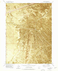
1973 · Aragonite
USGS Topo · 1:24,000