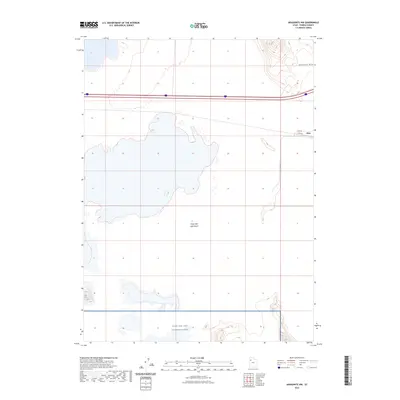
2023 Map of Aragonite NW
USGS Topo · Published 2023About this map
The Great Salt Lake Desert dominates this landscape, reflecting the stark, expansive character of the eastern edge of the Great Basin. The small settlement of Clive sits as a lonely outpost along the southern reach of the Grayback Hills, serving as a critical access point for the surrounding transportation and military infrastructure. Modern transit corridors including Clive Rd, Clive Way, and Clive Complex Rd branch away from the main interstate thoroughfare to service the remote facilities in the area.
Find a feature on this map
8 named features on this map. Tap any name to fly to it.
Don’t see what you’re looking for? This feature index may not catch every label — zoom into the map to look around manually.
Map Details
Editions of this 2023 Aragonite NW Map
This is the sole edition of this map. No revisions or reprints were ever made.
Other maps of this area

1953 · Tooele
USGS Topo · 1:250,000

1955 · Tooele
USGS Topo · 1:250,000

1973 · Ripple Valley
USGS Topo · 1:24,000

1973 · Knolls
USGS Topo · 1:24,000

1973 · Aragonite NW
USGS Topo · 1:24,000

1973 · Knolls SE
USGS Topo · 1:24,000

1973 · Grayback Hills
USGS Topo · 1:24,000

1973 · Aragonite SE
USGS Topo · 1:24,000

1973 · Aragonite SW
USGS Topo · 1:24,000
1973 · Aragonite
USGS Topo · 1:24,000