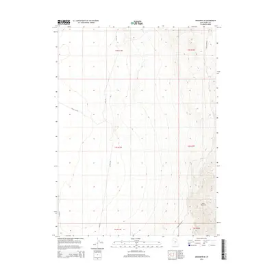
2014 Map of Aragonite SE
USGS Topo · Published 2014About this map
The Cedar Mountains dominate the eastern landscape of this 2014 survey in Tooele County, defining a sharp elevation contrast against the arid basins to the west. This territory is marked by a sparse network of desert routes, most notably Watson Rd and Quincy Flats Rd, which cross the open flats. The mapping reflects a landscape of modern land management and remote access, where the terrain transitions from the low-lying Quincy Flats up into the higher reaches of the range. The alignment of Cedar Mountain Rd along the eastern edge of the quadrangle serves as a primary artery through this uninhabited stretch of the Great Basin, providing the essential infrastructure for navigating the high desert environment.
Find a feature on this map
11 named features on this map. Tap any name to fly to it.
Don’t see what you’re looking for? This feature index may not catch every label — zoom into the map to look around manually.
Map Details
Editions of this 2014 Aragonite SE Map
This is the sole edition of this map. No revisions or reprints were ever made.
Other maps of this area

1885 · Tooele Valley
USGS Topo · 1:250,000

1953 · Tooele
USGS Topo · 1:250,000

1954 · Wig Mtn NW
USGS Topo · 1:24,000

1955 · Tabbys Peak
USGS Topo · 1:24,000

1955 · Wig Mtn NE
USGS Topo · 1:24,000

1955 · Tooele
USGS Topo · 1:250,000

1973 · Quincy Spring
USGS Topo · 1:24,000

1973 · Aragonite NW
USGS Topo · 1:24,000

1973 · Hastings Pass
USGS Topo · 1:24,000

1973 · Aragonite SE
USGS Topo · 1:24,000