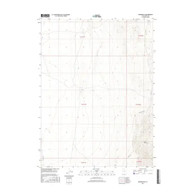
2017 Map of Aragonite SE
USGS Topo · Published 2017About this map
The Cedar Mountains dominate the eastern landscape of this Tooele County region, creating a stark topographic divide between the highlands and the basin floor. This 2017 survey by the U.S. Geological Survey details a landscape defined by isolation and traditional transit routes through the desert. The transit network is sparse, centered primarily on the Cedar Mt Rd and Cedar Mountain Rd which skirt the base of the range, while Skull Valley Rd marks the western extent of the study area. These roads follow the natural contours of the land, illustrating how the physical geography of the Great Basin dictates human movement and land use within the township and range survey system.
Find a feature on this map
10 named features on this map. Tap any name to fly to it.
Don’t see what you’re looking for? This feature index may not catch every label — zoom into the map to look around manually.
Map Details
Editions of this 2017 Aragonite SE Map
This is the sole edition of this map. No revisions or reprints were ever made.
Other maps of this area

1885 · Tooele Valley
USGS Topo · 1:250,000

1953 · Tooele
USGS Topo · 1:250,000

1954 · Wig Mtn NW
USGS Topo · 1:24,000

1955 · Tabbys Peak
USGS Topo · 1:24,000

1955 · Wig Mtn NE
USGS Topo · 1:24,000

1955 · Tooele
USGS Topo · 1:250,000

1973 · Quincy Spring
USGS Topo · 1:24,000

1973 · Aragonite NW
USGS Topo · 1:24,000

1973 · Hastings Pass
USGS Topo · 1:24,000

1973 · Aragonite SE
USGS Topo · 1:24,000