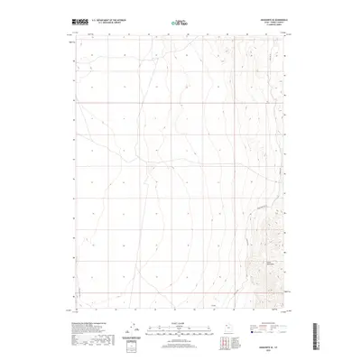
2020 Map of Aragonite SE
USGS Topo · Published 2020About this map
The Cedar Mountains dominate the eastern reaches of this Great Basin landscape, where steep topography meets the desert floor of the western Skull Valley Rd corridor. This 2020 survey documents a transition between the elevated ridgelines of the range and the vast alluvial flats to the west. Human presence is defined primarily by historic transport routes, notably the Cedar Mountain Rd and Cedar Mt Rd, which skirt the base of the mountains. These roads provide a primary means of navigating this arid environment, connecting the remote slopes to the broader regional network represented by Skull Valley Rd on the western edge. The map captures the stark environmental character of this portion of Tooele County, where drainage patterns from the mountains disappear into the valley basin.
Find a feature on this map
4 named features on this map. Tap any name to fly to it.
Don’t see what you’re looking for? This feature index may not catch every label — zoom into the map to look around manually.
Map Details
Editions of this 2020 Aragonite SE Map
This is the sole edition of this map. No revisions or reprints were ever made.
Other maps of this area

1885 · Tooele Valley
USGS Topo · 1:250,000

1953 · Tooele
USGS Topo · 1:250,000

1954 · Wig Mtn NW
USGS Topo · 1:24,000

1955 · Tabbys Peak
USGS Topo · 1:24,000

1955 · Wig Mtn NE
USGS Topo · 1:24,000

1955 · Tooele
USGS Topo · 1:250,000

1973 · Quincy Spring
USGS Topo · 1:24,000

1973 · Aragonite NW
USGS Topo · 1:24,000

1973 · Hastings Pass
USGS Topo · 1:24,000

1973 · Aragonite SE
USGS Topo · 1:24,000