
1954 Map of Aransas Pass
USGS Topo · Published 1964About this map
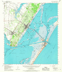
Live Oak Ridge and the Live Oak Peninsula dominate this mid-century coastal landscape where the industrial expansion of Aransas Pass meets the intricate waterways of the Texas Bend. The map captures a moment of transition for Ingleside and Port Ingleside, showing the developing shoreline along Ingleside Cove and the extensive dredging for the La Quinta Channel. Across the shallow waters of Redfish Bay, the barrier islands of St Joseph Island and Mustang Island shield the mainland, connected by the Port Aransas Causeway and the Lydia Ann Channel. Evidence of the region's diverse economy is visible in the Oil Field operations in Corpus Christi Bay and the rail infrastructure of the Southern Pacific and Texas and New Orleans RR. Local history is preserved in landmarks like the Prairie View Cem and the remote Grant Ranch on the flats of Mustang Island.
Find a feature on this map
70 named features on this map. Tap any name to fly to it.
Don’t see what you’re looking for? This feature index may not catch every label — zoom into the map to look around manually.
Map Details
Editions of this 1954 Aransas Pass Map
2 editions found
Other maps of this area

1925 · Aransas Pass
USGS Topo · 1:62,500

1925 · Oso Creek
USGS Topo · 1:62,500

1925 · Corpus Christi
USGS Topo · 1:62,500

1950 · Corpus Christi
USGS Topo · 1:250,000

1951 · Portland
USGS Topo · 1:24,000

1951 · Corpus Christi
USGS Topo · 1:62,500

1951 · Crane Islands NW
USGS Topo · 1:24,000

1951 · Oso Creek NE
USGS Topo · 1:24,000

1951 · Allyns Bight
USGS Topo · 1:24,000

1951 · Oso Creek
USGS Topo · 1:62,500