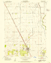
1952 Map of Arbuckle
USGS Topo · Published 1953About this map
Arbuckle and College City anchor the southern reach of the Colusa Basin in this 1952 study, a landscape defined by intensive irrigation and the legacy of the Southern Pacific railroad. The rail line cuts a straight diagonal through the terrain, serving the small siding at Genevra and the larger town of Arbuckle, where the Pierce Union High School and a Cem are clearly marked. To the north, the Colusa Nat Wildlife Refuge sits near the Glenn Co Colusa Co boundary, illustrating the early preservation of wetlands amidst the expanding agricultural grid. The intricate network of drainage, including the North Branch Sand Creek and South Branch Sand Creek, highlights the complex water management required for this region. Local landmarks like the Radio Range Station and a Landing Field point to the era's navigational infrastructure.
Find a feature on this map
27 named features on this map. Tap any name to fly to it.
Don’t see what you’re looking for? This feature index may not catch every label — zoom into the map to look around manually.
Map Details
Editions of this 1952 Arbuckle Map
3 editions found
Other maps of this area

1888 · Marysville
USGS Topo · 1:125,000

1891 · Marysville
USGS Topo · 1:125,000

1894 · Marysville
USGS Topo · 1:125,000

1895 · Marysville
USGS Topo · 1:125,000

1905 · Harrington
USGS Topo · 1:24,000

1907 · Dunnigan
USGS Topo · 1:62,500

1907 · Colusa
USGS Topo · 1:62,500

1911 · Grimes
USGS Topo · 1:31,680

1912 · Meridian
USGS Topo · 1:31,680

1916 · Harrington
USGS Topo · 1:31,680