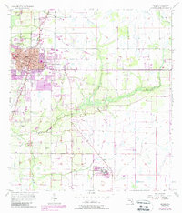
1957 Map of Arcadia
USGS Topo · Published 1988About this map
The city of Arcadia serves as the focal point of this 1950s survey, updated with late 1980s revisions to show the town's expansion toward the east and south. This map details the civic core, including the Courthouse and a grid of streets such as Whidden Ave and Polk Ave, while also capturing the transition into the surrounding agricultural and marshy terrain of DeSoto County. Notable institutional landmarks like the G Pierce Wood Memorial Hospital and the early stages of the Arcadia Municipal Airport illustrate the infrastructure development of the era.
Find a feature on this map
29 named features on this map. Tap any name to fly to it.
Don’t see what you’re looking for? This feature index may not catch every label — zoom into the map to look around manually.
Map Details
Editions of this 1957 Arcadia Map
4 editions found
Other maps of this area

1956 · Gardner
USGS Topo · 1:24,000

1956 · Arcadia SE
USGS Topo · 1:24,000

1956 · Limestone
USGS Topo · 1:24,000

1956 · Ft. Ogden
USGS Topo · 1:24,000

1956 · Nocatee
USGS Topo · 1:24,000

1956 · Crewsville SW
USGS Topo · 1:24,000

1956 · Long Island Marsh SW
USGS Topo · 1:24,000

1956 · Fort Pierce
USGS Topo · 1:250,000

1957 · Long Island Marsh NW
USGS Topo · 1:24,000

1957 · Arcadia
USGS Topo · 1:24,000