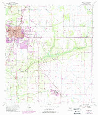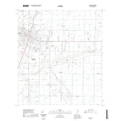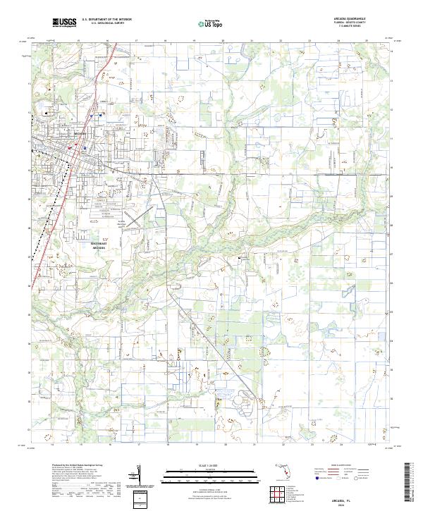
1978 Map of Arcadia
USGS Topo · Published 1980About this map
The Peace River and the vast waters of Lake Istokpoga anchor this late 1970s landscape, illustrating the agricultural and conservation patterns of South Central Florida. The map reveals the critical hydraulic infrastructure of the region, including the Indian Prairie Canal and Harney Pond Canal that manage water flow toward the south. Near the intersection of several county lines, the Archbold Biological Station and Highlands Hammock State Park represent significant preserved natural areas amidst the growing citrus and cattle lands. Settlements like Arcadia and Sebring serve as primary hubs, connected by the Seaboard Coast Line railroad which parallels major road corridors. To the southeast, the Brighton Indian Reservation occupies a significant portion of the glades, while scattered communities such as Venus and Fort Ogden mark the rural character of DeSoto and Highlands counties during this era of transition.
Find a feature on this map
81 named features on this map. Tap any name to fly to it.
Don’t see what you’re looking for? This feature index may not catch every label — zoom into the map to look around manually.
Map Details
Editions of this 1978 Arcadia Map
This is the sole edition of this map. No revisions or reprints were ever made.
Historical Maps of Sebring Through Time
7 maps found