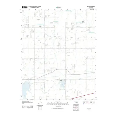
2010 Map of Arcadia
USGS Topo · Published 2010About this map
Arcadia sits at the heart of this landscape, where the waters of Deep Fork and Coffee Creek converge. The topography is defined by significant water management infrastructure, including the Hiwassee Lake Dam and several reservoirs labeled under the Oknoname and Bear Fall Coon Creek series. These artificial lakes, such as Lake Hiwassee and Lake Arcadia, underscore the hydraulic engineering that shaped central Oklahoma's mid-century development.
Find a feature on this map
70 named features on this map. Tap any name to fly to it.
Don’t see what you’re looking for? This feature index may not catch every label — zoom into the map to look around manually.
Map Details
Editions of this 2010 Arcadia Map
This is the sole edition of this map. No revisions or reprints were ever made.
Other maps of this area

1892 · Guthrie
USGS Topo · 1:62,500

1892 · Edmond
USGS Topo · 1:62,500

1909 · Luther
USGS Topo · 1:62,500

1909 · Perkins
USGS Topo · 1:62,500

1935 · Spencer
USGS Topo · 1:24,000

1935 · Edmond
USGS Topo · 1:48,000

1940 · Edmond
USGS Topo · 1:62,500

1954 · Oklahoma City
USGS Topo · 1:250,000
1955 · Jones
USGS Topo · 1:24,000

1956 · Horseshoe Lake
USGS Topo · 1:24,000