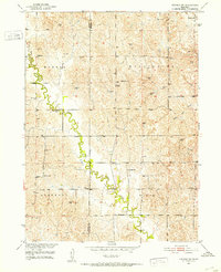
1951 Map of Arcadia SW
USGS Topo · Published 1953About this map
The meandering course of Clear Creek defines the western landscape of this mid-century Nebraska survey, marking the boundary between Custer and Sherman counties. This agrarian region is characterized by its organized township system, including the districts of Myrtle, Washington, Algernon, and Elm. The map reveals a high density of rural schoolhouses, such as Balloursa Sch and Deem Sch, which served the scattered farmstead population before the widespread consolidation of rural districts.
Find a feature on this map
18 named features on this map. Tap any name to fly to it.
Don’t see what you’re looking for? This feature index may not catch every label — zoom into the map to look around manually.
Map Details
Editions of this 1951 Arcadia SW Map
3 editions found
Other maps of this area

1951 · Ansley NE
USGS Topo · 1:24,000

1951 · Arcadia SE
USGS Topo · 1:24,000

1951 · Litchfield NE
USGS Topo · 1:24,000

1951 · Arcadia West
USGS Topo · 1:24,000

1951 · Arcadia East
USGS Topo · 1:24,000

1951 · Mason City
USGS Topo · 1:24,000

1951 · Ansley SE
USGS Topo · 1:24,000

1951 · Arcadia SW
USGS Topo · 1:24,000

1951 · Litchfield
USGS Topo · 1:24,000

1955 · Broken Bow
USGS Topo · 1:250,000