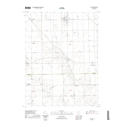
2019 Map of Arcanum
USGS Topo · Published 2019About this map
Arcanum serves as the primary hub of this Western Ohio landscape, situated at the junction of the Millers Fork and several major county routes. The 2019 survey documents a dense network of small rural settlements including Beechgrove, Ithaca, and Castine, each maintaining its distinct identity within the surrounding agricultural grid. The transition across the Darke Co Preble Co line reveals a series of smaller hamlets such as West Sonora and West Manchester, where the terrain begins to slope toward the drainages of Lick Run and Dry Fork.
Find a feature on this map
85 named features on this map. Tap any name to fly to it.
Don’t see what you’re looking for? This feature index may not catch every label — zoom into the map to look around manually.
Map Details
Editions of this 2019 Arcanum Map
This is the sole edition of this map. No revisions or reprints were ever made.
Other maps of this area

1905 · Brookville
USGS Topo · 1:62,500

1911 · Covington
USGS Topo · 1:62,500

1944 · Covington
USGS Topo · 1:62,500

1953 · Cincinnati
USGS Topo · 1:250,000

1953 · Muncie
USGS Topo · 1:250,000

1956 · Muncie
USGS Topo · 1:250,000

1957 · Cincinnati
USGS Topo · 1:250,000

1960 · New Madison
USGS Topo · 1:24,000
1960 · Eaton North
USGS Topo · 1:24,000

1961 · Laura
USGS Topo · 1:24,000