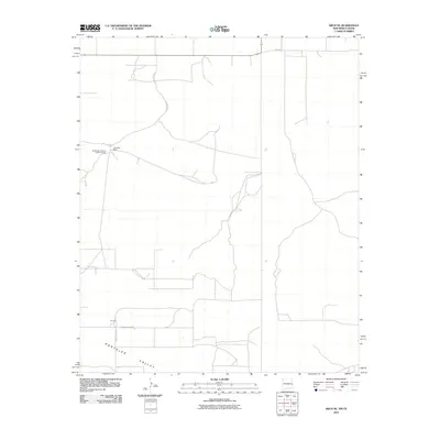
2010 Map of Arch NE
USGS Topo · Published 2010About this map
Portales Valley defines the southern landscape of this High Plains quadrangle, where the flat terrain of Roosevelt County meets the Texas-New Mexico border. The map documents a predominantly agricultural and ranching environment at the start of the 21st century, anchored by the Blackwater Land and Cattle Company and the Coldwater Ranch in the northwestern quadrant. A network of rural section roads, including Blackwater Rd and S Roosevelt Road 8, provide access to isolated residential and industrial footprints like Purchell. This survey reveals the persistent grid pattern of the American West, where modern state routes like FM-1760 cross the state line, illustrating the cross-border connectivity of these ranching communities.
Find a feature on this map
8 named features on this map. Tap any name to fly to it.
Don’t see what you’re looking for? This feature index may not catch every label — zoom into the map to look around manually.
Map Details
Editions of this 2010 Arch NE Map
This is the sole edition of this map. No revisions or reprints were ever made.
Other maps of this area

1954 · Clovis
USGS Topo · 1:250,000

1957 · Clovis
USGS Topo · 1:62,500

1957 · Arch
USGS Topo · 1:62,500

1958 · Clovis
USGS Topo · 1:250,000

1962 · Stegall
USGS Topo · 1:24,000

1962 · Birdwell Ranch
USGS Topo · 1:24,000

1963 · Lariat
USGS Topo · 1:24,000

1985 · Midway
USGS Topo · 1:24,000

1985 · Pleasure Lake
USGS Topo · 1:24,000

1985 · Muleshoe
USGS Topo · 1:100,000