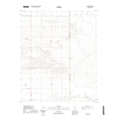
2020 Map of Arch NE
USGS Topo · Published 2020About this map
The Portales Valley defines this arid stretch of the High Plains, where the state line between New Mexico and Texas creates a sharp administrative boundary through a landscape of shallow depressions and undulating terrain. This 2020 survey documents the rural character of Roosevelt County, showing a geometric grid of property lines and section corners that dictate the path of local corridors such as S Roosevelt Road A and S Roosevelt Road 8. The lack of dense settlements is characteristic of this part of the Llano Estacado, where land use is primarily defined by ranching and agriculture. Notable thoroughfares like Blackwater Rd and Fm 1760 provide the primary connection points for the sparse ranch complexes and agricultural operations that dot the landscape in the vicinity of t1s r37e and the surrounding townships.
Find a feature on this map
13 named features on this map. Tap any name to fly to it.
Don’t see what you’re looking for? This feature index may not catch every label — zoom into the map to look around manually.
Map Details
Editions of this 2020 Arch NE Map
This is the sole edition of this map. No revisions or reprints were ever made.
Other maps of this area

1954 · Clovis
USGS Topo · 1:250,000

1957 · Clovis
USGS Topo · 1:62,500

1957 · Arch
USGS Topo · 1:62,500

1958 · Clovis
USGS Topo · 1:250,000

1962 · Stegall
USGS Topo · 1:24,000

1962 · Birdwell Ranch
USGS Topo · 1:24,000

1963 · Lariat
USGS Topo · 1:24,000

1985 · Midway
USGS Topo · 1:24,000

1985 · Pleasure Lake
USGS Topo · 1:24,000

1985 · Muleshoe
USGS Topo · 1:100,000