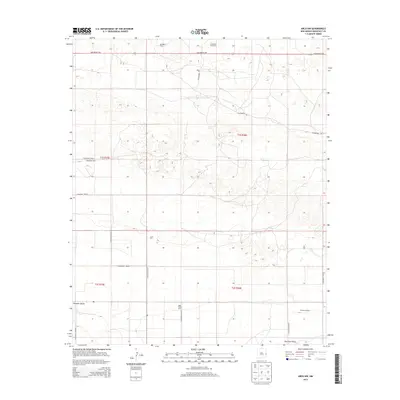
2013 Map of Arch NW
USGS Topo · Published 2013About this map
The agricultural landscape of the High Plains comes into sharp focus in this Roosevelt County survey. The Portales Valley dominates the southern reaches of the map, illustrating a terrain defined by its specialized dairy industry. Commercial operations such as Red Roof Dairy, Greenfield Park Dairy, and Schilderink Dairy are distributed across the township grids, reflecting the economic backbone of this rural New Mexico corridor.
Find a feature on this map
22 named features on this map. Tap any name to fly to it.
Don’t see what you’re looking for? This feature index may not catch every label — zoom into the map to look around manually.
Map Details
Editions of this 2013 Arch NW Map
This is the sole edition of this map. No revisions or reprints were ever made.
Other maps of this area

1954 · Clovis
USGS Topo · 1:250,000

1957 · Portair
USGS Topo · 1:62,500

1957 · Clovis
USGS Topo · 1:62,500

1957 · Arch
USGS Topo · 1:62,500

1957 · Portales
USGS Topo · 1:62,500

1958 · Clovis
USGS Topo · 1:250,000

1985 · Midway
USGS Topo · 1:24,000
1985 · Portales SE
USGS Topo · 1:24,000

1985 · Pleasure Lake
USGS Topo · 1:24,000
1985 · Arch
USGS Topo · 1:24,000