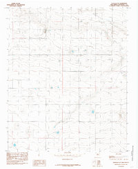
1985 Map of Portales SE
USGS Topo · Published 1985About this map
Portales Valley defines the topographic character of this 1980s landscape, where a sprawling network of irrigation and industry reveals the intensive agricultural use of the Roosevelt County basin. The terrain is marked by a high density of wells and several instances of wells, indicating the critical reliance on groundwater in this part of New Mexico. Industrial activity is grounded in several specific sites, including a feed lot and a gravel pit, which punctuate the rural sections alongside evidence of geologic exploration like a drill hole. Infrastructure is sparse but modern for the era, centered on a Trans Line Single Pole that traverses the territory, supporting the utility needs of the valley's distributed farming operations.
Find a feature on this map
7 named features on this map. Tap any name to fly to it.
Don’t see what you’re looking for? This feature index may not catch every label — zoom into the map to look around manually.
Map Details
Editions of this 1985 Portales SE Map
This is the sole edition of this map. No revisions or reprints were ever made.
Other maps of this area

1954 · Clovis
USGS Topo · 1:250,000

1954 · Brownfield
USGS Topo · 1:250,000

1957 · Arch
USGS Topo · 1:62,500

1957 · Portales
USGS Topo · 1:62,500

1958 · Brownfield
USGS Topo · 1:250,000

1958 · Clovis
USGS Topo · 1:250,000

1962 · Brownfield
USGS Topo · 1:250,000

1972 · Dora NW
USGS Topo · 1:24,000
1972 · Causey West
USGS Topo · 1:24,000

1972 · Dora
USGS Topo · 1:24,000