
1972 Map of Dora
USGS Topo · Published 1975About this map
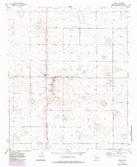
High plains topography and the distinct geometry of rural New Mexico define the landscape around the village of Dora. At this point in the early 1970s, the community is clearly delineated by its Corporate Boundary, serving as a central hub for the surrounding livestock and agricultural operations. The map reveals the essential infrastructure of a water-dependent region, where numerous individual wells dot the sections and a concentration of wells appears southwest of the main settlement.
Find a feature on this map
9 named features on this map. Tap any name to fly to it.
Don’t see what you’re looking for? This feature index may not catch every label — zoom into the map to look around manually.
Map Details
Editions of this 1972 Dora Map
2 editions found
Other maps of this area

1954 · Clovis
USGS Topo · 1:250,000

1954 · Brownfield
USGS Topo · 1:250,000

1957 · Arch
USGS Topo · 1:62,500

1957 · Portales
USGS Topo · 1:62,500

1958 · Brownfield
USGS Topo · 1:250,000

1958 · Clovis
USGS Topo · 1:250,000

1962 · Brownfield
USGS Topo · 1:250,000

1972 · Dora NW
USGS Topo · 1:24,000

1972 · Garrison
USGS Topo · 1:24,000

1972 · Dora SW
USGS Topo · 1:24,000