
1972 Map of Dora NW
USGS Topo · Published 1975About this map
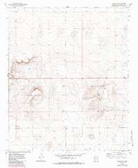
Red Lake and the subtle depressions of the Llano Estacado define this portion of Roosevelt County as it appeared in the early 1970s. The landscape is characterized by its wide-open ranching or agricultural character, marked by a systematic grid of section lines and range boundaries including R. 33 E. and R. 34 E. and the township division of T. 4 S. and T. 5 S. infrastructure such as a prominent north-south Pipeline and a scattered Gravel Pit or Water Tank indicate the utility of the land during this era. The topographic survey reveals the high plains terrain, where slight elevation changes around dry or seasonal lake beds provided the only natural landmarks for early residents and land surveyors in this corner of New Mexico.
Find a feature on this map
7 named features on this map. Tap any name to fly to it.
Don’t see what you’re looking for? This feature index may not catch every label — zoom into the map to look around manually.
Map Details
Editions of this 1972 Dora NW Map
2 editions found
Other maps of this area

1954 · Clovis
USGS Topo · 1:250,000

1954 · Brownfield
USGS Topo · 1:250,000

1957 · Portales
USGS Topo · 1:62,500

1958 · Brownfield
USGS Topo · 1:250,000

1958 · Clovis
USGS Topo · 1:250,000

1962 · Brownfield
USGS Topo · 1:250,000

1972 · Dora SW
USGS Topo · 1:24,000
1972 · Pep
USGS Topo · 1:24,000

1972 · Dora
USGS Topo · 1:24,000

1973 · Floyd SE
USGS Topo · 1:24,000