
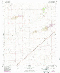
1973 Map of Floyd SE
USGS Topo · Published 1976About this map
Atchison Topeka and Santa Fe railroad tracks cut a sharp diagonal through this Roosevelt County landscape, anchoring the transit corridor of the early 1970s. The settlement of Kermit sits near the southern edge of the sheet, identified by a Radio Tower and its proximity to the rail line. Much of the surrounding terrain is defined by the ephemeral Boone Draw, which meanders through the high plains, and significant patches of Sand Dunes that speak to the arid environment. Industrial activity is evident in the form of a Gravel Pit and a Drill Hole, alongside a major Pipeline that traverses the northern and central sections. This survey provides a clear view of the ranching and resource-extraction infrastructure that shaped this portion of New Mexico before later modern developments changed the local footprint.
Find a feature on this map
8 named features on this map. Tap any name to fly to it.
Don’t see what you’re looking for? This feature index may not catch every label — zoom into the map to look around manually.
Map Details
Editions of this 1973 Floyd SE Map
2 editions found
Other maps of this area

1954 · Clovis
USGS Topo · 1:250,000

1954 · Brownfield
USGS Topo · 1:250,000

1957 · Portales
USGS Topo · 1:62,500

1958 · Brownfield
USGS Topo · 1:250,000

1958 · Clovis
USGS Topo · 1:250,000

1962 · Brownfield
USGS Topo · 1:250,000

1972 · Dora NW
USGS Topo · 1:24,000

1973 · Floyd
USGS Topo · 1:24,000

1973 · Lewiston Lake
USGS Topo · 1:24,000

1973 · Upton
USGS Topo · 1:24,000