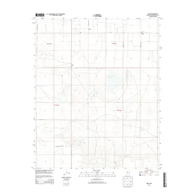
2013 Map of Arch
USGS Topo · Published 2013About this map
Arch serves as the focal point of this high plains landscape in eastern Roosevelt County, situated just west of the Texas border. The area is defined by a grid of rural routes, including S Roosevelt Road G and S Roosevelt Road 15, which connect dispersed ranching sites and historic resting places. Genealogists and local historians will find significant detail in the mapping of Arch Cem and the more isolated Eiland Cem, marking the early settlement history of the region. The natural geography is characterized by depressions and water management features essential for livestock, notably the Little Salt Lake and several catchment basins including West Tank, East Tank, and Middle Tank. The presence of the Phillips Ranch underscores the enduring agricultural character of this portion of the Llano Estacado.
Find a feature on this map
20 named features on this map. Tap any name to fly to it.
Don’t see what you’re looking for? This feature index may not catch every label — zoom into the map to look around manually.
Map Details
Editions of this 2013 Arch Map
This is the sole edition of this map. No revisions or reprints were ever made.
Other maps of this area

1954 · Clovis
USGS Topo · 1:250,000

1954 · Brownfield
USGS Topo · 1:250,000

1957 · Arch
USGS Topo · 1:62,500

1957 · Portales
USGS Topo · 1:62,500

1958 · Brownfield
USGS Topo · 1:250,000

1958 · Clovis
USGS Topo · 1:250,000

1962 · Brownfield
USGS Topo · 1:250,000

1970 · Causey East
USGS Topo · 1:24,000
1972 · Causey West
USGS Topo · 1:24,000

1972 · Dora
USGS Topo · 1:24,000