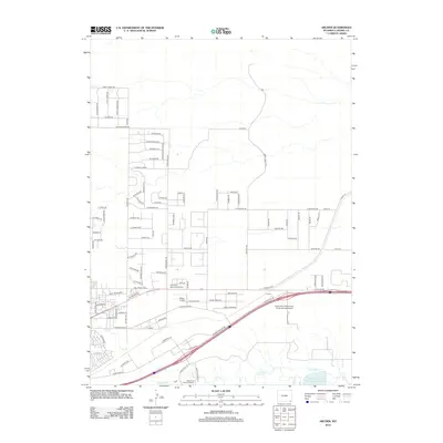
2012 Map of Archer
USGS Topo · Published 2012About this map
The University of Wyoming Experimental Station and the agricultural landscape of eastern Laramie County define this region on the outskirts of Cheyenne. The map reveals a transition from traditional ranching and irrigation, evidenced by the Bolln Ditch and Stewart Ditch, to modern suburban development. While the small settlement of Archer and the Sloan Airport mark specific hubs of activity, much of the area is subdivided by an extensive network of roads with names like Chief Twomoon Rd and Crystal Mountain Rd. Water management remains a critical feature of the terrain, as seen at the Wyoming Hereford Reservoir Number 2 along Crow Cr. This map documents the early 21st-century footprint of Laramie County's growth, balancing institutional research, aviation, and burial grounds like Cheyenne Memorial Gardens against the natural drainage of Dry Cr.
Find a feature on this map
98 named features on this map. Tap any name to fly to it.
Don’t see what you’re looking for? This feature index may not catch every label — zoom into the map to look around manually.
Map Details
Editions of this 2012 Archer Map
This is the sole edition of this map. No revisions or reprints were ever made.
Other maps of this area

1911 · Cheyenne
USGS Topo · 1:125,000

1914 · Cheyenne
USGS Topo · 1:125,000

1950 · Cheyenne
USGS Topo · 1:62,500

1954 · Cheyenne
USGS Topo · 1:250,000

1958 · Cheyenne
USGS Topo · 1:250,000

1961 · Cheyenne South
USGS Topo · 1:24,000

1961 · Cheyenne
USGS Topo · 1:62,500

1961 · Cheyenne North
USGS Topo · 1:24,000

1962 · P O Ranch
USGS Topo · 1:24,000

1963 · Pole Creek Ranch SE
USGS Topo · 1:24,000