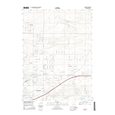
2015 Map of Archer
USGS Topo · Published 2015About this map
Cheyenne expands eastward across the High Plains in this early 21st-century record of Laramie County. The landscape is a mix of suburban development and agricultural infrastructure, where newer residential streets like Crested Butte Dr and Cloud Mesa Dr meet the long-established ranching heritage of the region. The map captures the vital role of water management in this arid environment, documenting the Wyoming Hereford Ranch Reservoir Number 2 and the network of irrigation channels including Bolin Ditch and Stewart Ditch.
Find a feature on this map
128 named features on this map. Tap any name to fly to it.
Don’t see what you’re looking for? This feature index may not catch every label — zoom into the map to look around manually.
Map Details
Editions of this 2015 Archer Map
This is the sole edition of this map. No revisions or reprints were ever made.
Other maps of this area

1911 · Cheyenne
USGS Topo · 1:125,000

1914 · Cheyenne
USGS Topo · 1:125,000

1950 · Cheyenne
USGS Topo · 1:62,500

1954 · Cheyenne
USGS Topo · 1:250,000

1958 · Cheyenne
USGS Topo · 1:250,000

1961 · Cheyenne South
USGS Topo · 1:24,000

1961 · Cheyenne
USGS Topo · 1:62,500

1961 · Cheyenne North
USGS Topo · 1:24,000

1962 · P O Ranch
USGS Topo · 1:24,000

1963 · Pole Creek Ranch SE
USGS Topo · 1:24,000