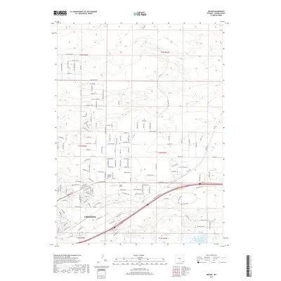
2017 Map of Archer
USGS Topo · Published 2017About this map
The eastern edges of Cheyenne meet the high plains on this 2017 survey, revealing a landscape defined by its vital water management and modern infrastructure. Irrigation works such as the Stewart Ditch and Bollin Ditch reflect the region's agricultural heritage, while the Wyoming Hereford Ranch Reservoir Number Two sits near the course of Crow Creek. The map documents a blend of established institutions like the Cheyenne Memorial Gardens and transportation nodes including Sloan Airport. To the east, the settlement of Archer marks a key point in the local geography, situated near the intersection of the regional rail corridor and the plains. Residential development is characterized by an extensive network of named streets, such as Iron Mountain Road and Cochise Road, which snake across the undulating terrain north of the city center.
Find a feature on this map
147 named features on this map. Tap any name to fly to it.
Don’t see what you’re looking for? This feature index may not catch every label — zoom into the map to look around manually.
Map Details
Editions of this 2017 Archer Map
This is the sole edition of this map. No revisions or reprints were ever made.
Other maps of this area

1911 · Cheyenne
USGS Topo · 1:125,000

1914 · Cheyenne
USGS Topo · 1:125,000

1950 · Cheyenne
USGS Topo · 1:62,500

1954 · Cheyenne
USGS Topo · 1:250,000

1958 · Cheyenne
USGS Topo · 1:250,000

1961 · Cheyenne South
USGS Topo · 1:24,000

1961 · Cheyenne
USGS Topo · 1:62,500

1961 · Cheyenne North
USGS Topo · 1:24,000

1962 · P O Ranch
USGS Topo · 1:24,000

1963 · Pole Creek Ranch SE
USGS Topo · 1:24,000