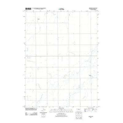
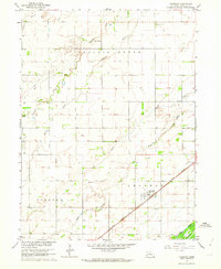
2011 Map of Archer
USGS Topo · Published 2011About this map
Archer serves as the primary settlement on this Nebraska plains landscape, where the terrain is defined by a complex network of waterways and an orderly grid of rural roads. The map illustrates a distinctive transition from the more structured agricultural uplands in the north to a low-lying riparian system in the south and east. Significant drainage is managed by Elk Creek and Moores Creek, while the meandering paths of Prairie Slough and Prairie Creek highlight the area's natural hydrology. This 2011 survey captures a moment in Merrick County's modern development, showing the persistent rural layout of numbered roads like 4th Rd and 9th Rd alongside local landmarks such as the Sullivan Airstrip. The arrangement of these features underscores the region's historical reliance on precise land division for farming and the vital role of local creek systems in defining the boundaries of habitable land.
Find a feature on this map
21 named features on this map. Tap any name to fly to it.
Don’t see what you’re looking for? This feature index may not catch every label — zoom into the map to look around manually.
Map Details
Editions of this 2011 Archer Map
This is the sole edition of this map. No revisions or reprints were ever made.
Other maps of this area

1899 · St. Paul
USGS Topo · 1:125,000

1955 · Belgrade SW
USGS Topo · 1:24,000

1955 · Broken Bow
USGS Topo · 1:250,000

1955 · Belgrade SE
USGS Topo · 1:24,000

1955 · Cushing
USGS Topo · 1:24,000

1956 · Broken Bow
USGS Topo · 1:250,000
1961 · Palmer
USGS Topo · 1:24,000
1961 · St. Libory
USGS Topo · 1:24,000
1962 · Central City West
USGS Topo · 1:24,000
1962 · Chapman
USGS Topo · 1:24,000