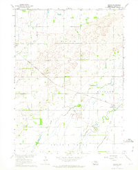
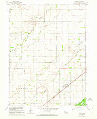
1962 Map of Archer
USGS Topo · Published 1964About this map
The community of Archer and the edge of Palmer anchor this 1960s survey of central Nebraska. The landscape is defined by the diagonal transit of the Chicago Burlington and Quincy railroad, which cuts through the townships of Loup, Midland, and Prairie Creek. The drainage patterns here are complex, featuring a network of seasonal and permanent waterways including Prairie Creek, Moores Creek, and Prairie Slough.
Find a feature on this map
13 named features on this map. Tap any name to fly to it.
Don’t see what you’re looking for? This feature index may not catch every label — zoom into the map to look around manually.
Map Details
Editions of this 1962 Archer Map
This is the sole edition of this map. No revisions or reprints were ever made.
Other maps of this area

1899 · St. Paul
USGS Topo · 1:125,000

1955 · Belgrade SW
USGS Topo · 1:24,000

1955 · Broken Bow
USGS Topo · 1:250,000

1955 · Belgrade SE
USGS Topo · 1:24,000

1955 · Cushing
USGS Topo · 1:24,000

1956 · Broken Bow
USGS Topo · 1:250,000
1961 · Palmer
USGS Topo · 1:24,000
1961 · St. Libory
USGS Topo · 1:24,000
1962 · Central City West
USGS Topo · 1:24,000
1962 · Chapman
USGS Topo · 1:24,000