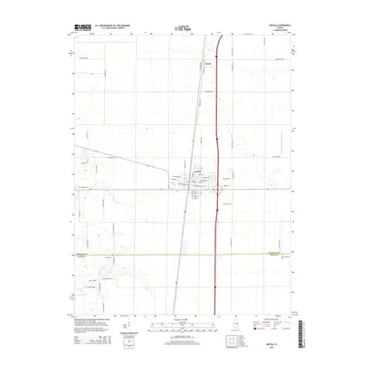
2015 Map of Arcola
USGS Topo · Published 2015About this map
Arcola serves as the central hub of this Douglas County landscape, where a dense grid of streets like W Main St and E Jefferson St meets the modern transport corridor of Interstate 57. To the north, the small community of Galton sits along the rail line, surrounded by a vast network of section roads that define the region's agricultural character. The southern portion of the map is marked by the winding course of the Kaskaskia River, which cuts through the flat prairie terrain near the border of Douglas and Coles counties.
Find a feature on this map
52 named features on this map. Tap any name to fly to it.
Don’t see what you’re looking for? This feature index may not catch every label — zoom into the map to look around manually.
Map Details
Editions of this 2015 Arcola Map
This is the sole edition of this map. No revisions or reprints were ever made.
Other maps of this area

1935 · Arcola
USGS Topo · 1:48,000

1936 · Oakland
USGS Topo · 1:48,000

1940 · Arcola
USGS Topo · 1:62,500

1942 · Oakland
USGS Topo · 1:62,500

1950 · Tuscola
USGS Topo · 1:62,500

1956 · Villa Grove
USGS Topo · 1:62,500

1958 · Decatur
USGS Topo · 1:250,000

1961 · Decatur
USGS Topo · 1:250,000
1975 · Tuscola SW
USGS Topo · 1:24,000
1975 · Tuscola SE
USGS Topo · 1:24,000