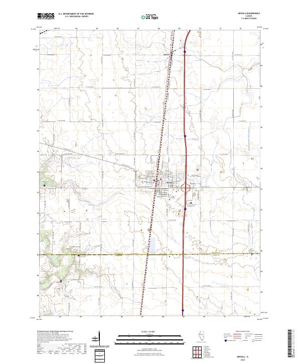
2024 Map of Arcola
USGS Topo · Published 2024About this map
Arcola serves as the central hub of this Illinois landscape, situated at the boundary of Douglas Co and Coles Co. The area is defined by a rigorous grid of section lines and rural routes, such as E Co Rd 300N and N Co Rd 800E, reflecting the organized agricultural development of the prairie. To the north, the small settlement of Galton sits along the primary transport corridor. For local history researchers, the map identifies several scattered burial grounds, including Campbell Cem and Gardner Cem, which represent the early family and community roots of the region. The southern portion of the sheet is marked by the winding course of the Kaskaskia River, providing a natural contrast to the engineered precision of the Arcola Drainage Ditch Number 4 to the northeast.
Find a feature on this map
69 named features on this map. Tap any name to fly to it.
Don’t see what you’re looking for? This feature index may not catch every label — zoom into the map to look around manually.
Map Details
Editions of this 2024 Arcola Map
This is the sole edition of this map. No revisions or reprints were ever made.
Other maps of this area

1935 · Arcola
USGS Topo · 1:48,000

1936 · Oakland
USGS Topo · 1:48,000

1940 · Arcola
USGS Topo · 1:62,500

1942 · Oakland
USGS Topo · 1:62,500

1950 · Tuscola
USGS Topo · 1:62,500

1956 · Villa Grove
USGS Topo · 1:62,500

1958 · Decatur
USGS Topo · 1:250,000

1961 · Decatur
USGS Topo · 1:250,000
1975 · Tuscola SW
USGS Topo · 1:24,000
1975 · Tuscola SE
USGS Topo · 1:24,000