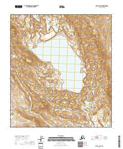
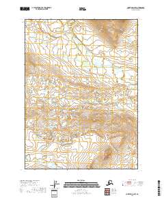
2018 Map of Arctic A-2 SW
USGS Topo · Published 2018About this map
Old John Lake dominates this interior landscape within the Yukon-Koyukuk Census Area, serving as a primary hydrologic focal point for the surrounding terrain. To the north, the waters of Island Lake and Soloman Lake sit amidst a complex network of wetlands and seasonal drainages, reflecting the low-relief topography characteristic of this subarctic region. The western edge of the survey is defined by the elevation of Shark Edge Mtn, which provides a topographical contrast to the lacustrine basins to the east. In the southeastern portion of the quadrangle, Vanticlese Cr meanders through the landscape, contributing to the drainage patterns of the larger lake system. This 2018 survey illustrates the remote character of the Brooks Range foothills, where water and high ground dictate the movement across the territory.
Find a feature on this map
11 named features on this map. Tap any name to fly to it.
Don’t see what you’re looking for? This feature index may not catch every label — zoom into the map to look around manually.
Map Details
Editions of this 2018 Arctic A-2 SW Map
This is the sole edition of this map. No revisions or reprints were ever made.
Other maps of this area

1951 · Christian
USGS Topo · 1:250,000

1951 · Arctic
USGS Topo · 1:250,000

1956 · Arctic
USGS Topo · 1:250,000

1956 · Christian
USGS Topo · 1:250,000

1972 · Arctic A-3
USGS Topo · 1:63,360
1972 · Christian D-2
USGS Topo · 1:63,360
1972 · Christian D-3
USGS Topo · 1:63,360

1972 · Arctic A-2
USGS Topo · 1:63,360
2018 · Arctic A-2 NW
USGS Topo · 1:25,000
2018 · Christian D-2 NW
USGS Topo · 1:25,000