
1972 Map of Arctic A-2
USGS Topo · Published 1976About this map
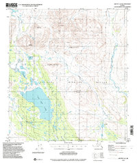
Old John Lake dominates the central landscape of this 1972 survey, situated within the Venetie Indian Reservation. The terrain is characterized by prominent peaks including Signal Mountain, Titus Mountain, Vorzui Mountain, and Old John Mountain, which rise above a network of drainages and wetlands. A remote Cabin sits near the western shore of the lake, providing evidence of local human activity in an area defined by its hydrology and relief. The Koness River meanders along the eastern edge of the quadrangle, while multiple smaller bodies of water like Cache Lake and Island Lake dot the lowlands between the mountain ranges. This map captures the region's complex water systems before modern shifts, highlighting the Indefinite Boundary and the South Boundary Umiat Meridian that define the land divisions in this interior Alaskan wilderness.
Find a feature on this map
19 named features on this map. Tap any name to fly to it.
Don’t see what you’re looking for? This feature index may not catch every label — zoom into the map to look around manually.
Map Details
Editions of this 1972 Arctic A-2 Map
2 editions found
Other maps of this area

1951 · Christian
USGS Topo · 1:250,000

1951 · Arctic
USGS Topo · 1:250,000

1956 · Arctic
USGS Topo · 1:250,000

1956 · Christian
USGS Topo · 1:250,000
1972 · Arctic A-1
USGS Topo · 1:63,360

1972 · Arctic A-3
USGS Topo · 1:63,360
1972 · Christian D-2
USGS Topo · 1:63,360
1972 · Christian D-3
USGS Topo · 1:63,360

1983 · Arctic B-2
USGS Topo · 1:63,360

1983 · Arctic B-3
USGS Topo · 1:63,360