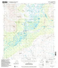
1972 Map of Arctic A-3
USGS Topo · Published 2000About this map
Arctic Village serves as the primary human settlement in this remote landscape, situated along the East Fork Chandalar River. The settlement is supported by a Landing Strip and proximity to local resources like a Gravel Pit, while the surrounding terrain is defined by a dense network of lakes and seasonal waterways. A Winter Trail provides ground access across the tundra, navigating between Kornui Lake and the Christian River. The map highlights the intersection of Indigenous land use and federal conservation, with the entire area contained within the Arctic National Wildlife Refuge. High elevations such as Coal Mountain and Shark Edge Mountain overlook the broad river valleys of the Junjik River and its numerous tributaries, including Tritt Creek and Deadman Creek. Notable local landmarks like the Cems and a Po near the village offer specific points of interest for genealogists tracing families in the Brooks Range.
Find a feature on this map
38 named features on this map. Tap any name to fly to it.
Don’t see what you’re looking for? This feature index may not catch every label — zoom into the map to look around manually.
Map Details
Editions of this 1972 Arctic A-3 Map
2 editions found
Other maps of this area

1951 · Christian
USGS Topo · 1:250,000

1951 · Arctic
USGS Topo · 1:250,000

1956 · Arctic
USGS Topo · 1:250,000

1956 · Christian
USGS Topo · 1:250,000

1972 · Arctic A-3
USGS Topo · 1:63,360
1972 · Arctic A-4
USGS Topo · 1:63,360
1972 · Christian D-3
USGS Topo · 1:63,360

1972 · Arctic A-2
USGS Topo · 1:63,360
1983 · Arctic B-4
USGS Topo · 1:63,360

1983 · Arctic B-2
USGS Topo · 1:63,360