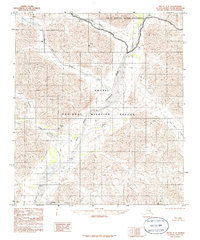
1983 Map of Arctic C-2
USGS Topo · Published 1986About this map
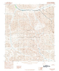
The East Fork Chandalar River and the main stem of the Chandalar River converge within this high-latitude drainage, defining a complex system of braided channels and alluvial fans. This 1983 provisional survey documents the northern interior as the federal boundaries for the Arctic National Wildlife Refuge and the Arctic Wildlife Refuge Wilderness were being formalized following the Alaska National Interest Lands Conservation Act. The topographic detail captures the hydrology of the Brooks Range foothills, where seasonal runoff feeds into Red Sheep Creek and Cane Creek. In the southern reaches, Vettatrin Lake sits within a low-lying basin, while the name of Old Woman Creek hints at the long-standing indigenous geography and traditional knowledge of this remote landscape.
Find a feature on this map
9 named features on this map. Tap any name to fly to it.
Don’t see what you’re looking for? This feature index may not catch every label — zoom into the map to look around manually.
Map Details
Editions of this 1983 Arctic C-2 Map
2 editions found
Other maps of this area

1951 · Arctic
USGS Topo · 1:250,000

1956 · Arctic
USGS Topo · 1:250,000
1983 · Arctic C-1
USGS Topo · 1:63,360

1983 · Arctic C-3
USGS Topo · 1:63,360

1983 · Arctic B-2
USGS Topo · 1:63,360
1983 · Arctic D-2
USGS Topo · 1:63,360

1983 · Arctic C-2
USGS Topo · 1:63,360

1983 · Arctic B-3
USGS Topo · 1:63,360
1983 · Arctic B-1
USGS Topo · 1:63,360
1983 · Arctic D-3
USGS Topo · 1:63,360