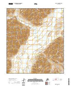
2018 Map of Arctic C-2 SW
USGS Topo · Published 2018About this map
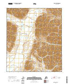
The East Fork Chandalar River dominates this high-latitude terrain within the North Slope Borough, carving a broad valley through the mountainous landscape. This 2018 survey reveals a wilderness defined by its water systems, where the river's braided course is fed by northern tributaries like Flatrock Creek (also labeled Flatrock Cr). The presence of Vettatrin Lake in the southern portion of the quadrangle highlights the complex glacial or permafrost-driven hydrology of the region. Without roads or permanent settlements, the map focuses on the raw topography and the Public Land Survey System grid, including Townships t9s r30e and t11s r31e, which provide the only human-imposed structure on this vast Alaskan expanse.
Find a feature on this map
11 named features on this map. Tap any name to fly to it.
Don’t see what you’re looking for? This feature index may not catch every label — zoom into the map to look around manually.
Map Details
Editions of this 2018 Arctic C-2 SW Map
This is the sole edition of this map. No revisions or reprints were ever made.
Other maps of this area

1951 · Arctic
USGS Topo · 1:250,000

1956 · Arctic
USGS Topo · 1:250,000

1983 · Arctic C-3
USGS Topo · 1:63,360

1983 · Arctic B-2
USGS Topo · 1:63,360

1983 · Arctic C-2
USGS Topo · 1:63,360

1983 · Arctic B-3
USGS Topo · 1:63,360
2018 · Arctic B-2 NW
USGS Topo · 1:25,000
2018 · Arctic B-2 NE
USGS Topo · 1:25,000
2018 · Arctic C-2 NW
USGS Topo · 1:25,000
2018 · Arctic C-2 NE
USGS Topo · 1:25,000