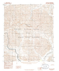
1983 Map of Arctic D-2
USGS Topo · Published 1986About this map
The Arctic Continental Divide bisects this remote section of the Brooks Range, separating the northern waters flowing toward the Arctic Ocean from the southern drainage system. To the north, the Canning River carves through high-elevation terrain, while the southern slopes are defined by the Red Sheep Creek and the East Fork Chandalar River. This 1983 provisional survey documents a landscape preserved within the Arctic National Wildlife Refuge, specifically highlighting the limits of the Arctic Wildlife Refuge Wilderness. The map shows a strictly natural environment with no roads or trails, emphasizing the vast, unpeopled character of the North Slope's interior. Researchers can trace the exact Wilderness Boundary as it follows specific topographic ridges and creek beds during this era of federal land designation.
Find a feature on this map
7 named features on this map. Tap any name to fly to it.
Don’t see what you’re looking for? This feature index may not catch every label — zoom into the map to look around manually.
Map Details
Editions of this 1983 Arctic D-2 Map
2 editions found
Other maps of this area

1951 · Arctic
USGS Topo · 1:250,000

1951 · Mt. Michelson
USGS Topo · 1:250,000

1956 · Arctic
USGS Topo · 1:250,000

1956 · Mt. Michelson
USGS Topo · 1:250,000

1983 · Mount Michelson A-3
USGS Topo · 1:63,360
1983 · Mount Michelson A-1
USGS Topo · 1:63,360

1983 · Mount Michelson A-2
USGS Topo · 1:63,360
1983 · Arctic C-1
USGS Topo · 1:63,360

1983 · Arctic C-3
USGS Topo · 1:63,360
1983 · Arctic D-2
USGS Topo · 1:63,360