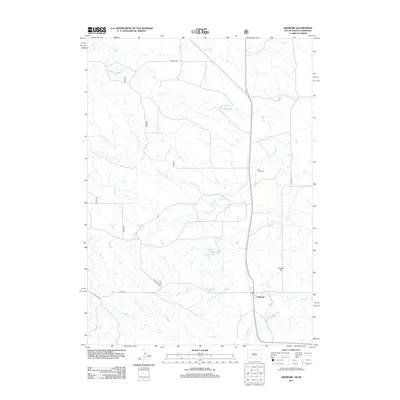
2012 Map of Ardmore
USGS Topo · Published 2012About this map
Ardmore sits at the southern edge of this West River landscape, serving as a focal point for the surrounding cattle country along the South Dakota and Nebraska border. The terrain is defined by a dense network of intermittent drainages, including the serpentine Hat Cr and its various tributaries like Duck Cr and Long Br Cr. These waterways cut through the high plains, shaping the local geography around landmarks such as Hunter Hill. Local history and genealogy are anchored by the Duck Creek Cem, which stands north of the settlement. The map reveals a remote ranching infrastructure where water management is critical, evidenced by features like Wasserburger Pond. A system of county roads, such as Co HWY 7b and Co RD 5, connects the dispersed homesteads and grazing lands across this borderland region.
Find a feature on this map
18 named features on this map. Tap any name to fly to it.
Don’t see what you’re looking for? This feature index may not catch every label — zoom into the map to look around manually.
Map Details
Editions of this 2012 Ardmore Map
This is the sole edition of this map. No revisions or reprints were ever made.
Other maps of this area

1902 · Edgemont
USGS Topo · 1:125,000

1950 · Heppner
USGS Topo · 1:24,000

1950 · Rumford
USGS Topo · 1:24,000

1955 · Hot Springs
USGS Topo · 1:250,000

1955 · Alliance
USGS Topo · 1:250,000

1957 · Alliance
USGS Topo · 1:250,000

1958 · Alliance
USGS Topo · 1:250,000

1980 · Montrose
USGS Topo · 1:24,000
1980 · Orella
USGS Topo · 1:24,000
1980 · Story NE
USGS Topo · 1:24,000