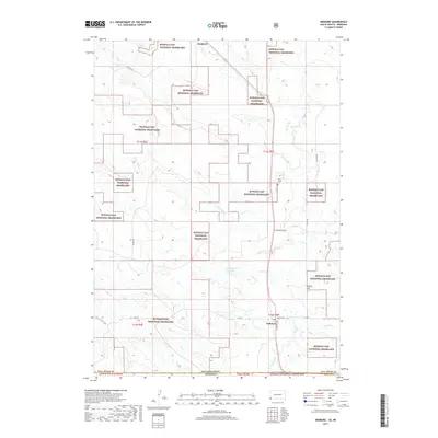
2017 Map of Ardmore
USGS Topo · Published 2017About this map
The high plains of the South Dakota-Nebraska border meet at Ardmore, a settlement located near the southern edge of the Buffalo Gap National Grassland. This 2017 survey details the transition into the Oglala National Grassland just across the state line in Sioux County, Nebraska. The landscape is defined by its intermittent drainage systems, including Hat Cr, Cow Cr, and Duck Cr, which converge across the open terrain.
Find a feature on this map
29 named features on this map. Tap any name to fly to it.
Don’t see what you’re looking for? This feature index may not catch every label — zoom into the map to look around manually.
Map Details
Editions of this 2017 Ardmore Map
This is the sole edition of this map. No revisions or reprints were ever made.
Other maps of this area

1902 · Edgemont
USGS Topo · 1:125,000

1950 · Heppner
USGS Topo · 1:24,000

1950 · Rumford
USGS Topo · 1:24,000

1955 · Hot Springs
USGS Topo · 1:250,000

1955 · Alliance
USGS Topo · 1:250,000

1957 · Alliance
USGS Topo · 1:250,000

1958 · Alliance
USGS Topo · 1:250,000

1980 · Montrose
USGS Topo · 1:24,000
1980 · Orella
USGS Topo · 1:24,000
1980 · Story NE
USGS Topo · 1:24,000