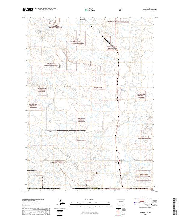
2021 Map of Ardmore
USGS Topo · Published 2021About this map
Buffalo Gap National Grassland dominates this high-plains landscape where the South Dakota-Nebraska state line bisects the prairie. The settlement of Ardmore serves as a local anchor near the southern boundary, while Rumford is situated further north along the rail corridor. This 2021 survey highlights a network of ephemeral watercourses including Hat Cr and Duck Cr, which carve through the terrain and drain toward the northeast.
Find a feature on this map
27 named features on this map. Tap any name to fly to it.
Don’t see what you’re looking for? This feature index may not catch every label — zoom into the map to look around manually.
Map Details
Editions of this 2021 Ardmore Map
This is the sole edition of this map. No revisions or reprints were ever made.
Other maps of this area

1902 · Edgemont
USGS Topo · 1:125,000

1950 · Heppner
USGS Topo · 1:24,000

1950 · Rumford
USGS Topo · 1:24,000

1955 · Hot Springs
USGS Topo · 1:250,000

1955 · Alliance
USGS Topo · 1:250,000

1957 · Alliance
USGS Topo · 1:250,000

1958 · Alliance
USGS Topo · 1:250,000

1980 · Montrose
USGS Topo · 1:24,000
1980 · Orella
USGS Topo · 1:24,000
1980 · Story NE
USGS Topo · 1:24,000