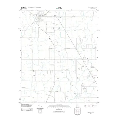
2011 Map of Ardmore
USGS Topo · Published 2011About this map
Ardmore straddles the Alabama-Tennessee line, serving as the primary hub for this agricultural and residential landscape. The town center is defined by its Ardmore Post Office and its proximity to the CSX rail line, while surrounding unincorporated communities like Bethel, Cedar Hill, and Oak Grove are linked by a network of established roads such as Pulaski Pike and Mooresville Rd. The drainage patterns of Piney Creek and Little Limestone Creek shape the rural topography, which is notably dense with family and community burial sites.
Find a feature on this map
93 named features on this map. Tap any name to fly to it.
Don’t see what you’re looking for? This feature index may not catch every label — zoom into the map to look around manually.
Map Details
Editions of this 2011 Ardmore Map
This is the sole edition of this map. No revisions or reprints were ever made.
Other maps of this area

1888 · Huntsville
USGS Topo · 1:125,000

1892 · Huntsville
USGS Topo · 1:125,000

1935 · Athens
USGS Topo · 1:24,000

1936 · Jeff
USGS Topo · 1:24,000

1936 · Capshaw
USGS Topo · 1:24,000

1936 · Taft
USGS Topo · 1:24,000

1936 · Elkmont
USGS Topo · 1:24,000

1936 · Ardmore
USGS Topo · 1:24,000

1936 · Toney
USGS Topo · 1:24,000

1936 · Elkton
USGS Topo · 1:24,000