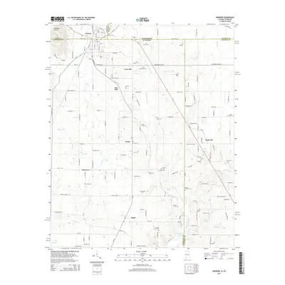
2014 Map of Ardmore
USGS Topo · Published 2014About this map
Ardmore sits directly on the state boundary, where the CSX Transportation rail line and local roads like State Line Rd divide Alabama and Tennessee. This survey documents a landscape of numerous family and community cemeteries, including Gatlin Cem, Austin Cem, and Tillery Cem, which suggest a deeply rooted rural genealogy across the county lines of Limestone, Giles, Madison, and Lincoln. The terrain is defined by the headwaters of several drainages, such as Piney Cr and Little Limestone Cr, punctuated by vital water sources like Wooley Spring and Old Limestone Church Spring. Small settlements like Bethel, Pisgah, and Maple Hill are interconnected by a network of named country roads, while the presence of Concord Church and numerous smaller burial grounds like Milhouse Cem and German Cem point to the enduring community centers of this border region.
Find a feature on this map
103 named features on this map. Tap any name to fly to it.
Don’t see what you’re looking for? This feature index may not catch every label — zoom into the map to look around manually.
Map Details
Editions of this 2014 Ardmore Map
This is the sole edition of this map. No revisions or reprints were ever made.
Other maps of this area

1888 · Huntsville
USGS Topo · 1:125,000

1892 · Huntsville
USGS Topo · 1:125,000

1935 · Athens
USGS Topo · 1:24,000

1936 · Jeff
USGS Topo · 1:24,000

1936 · Capshaw
USGS Topo · 1:24,000

1936 · Taft
USGS Topo · 1:24,000

1936 · Elkmont
USGS Topo · 1:24,000

1936 · Ardmore
USGS Topo · 1:24,000

1936 · Toney
USGS Topo · 1:24,000

1936 · Elkton
USGS Topo · 1:24,000