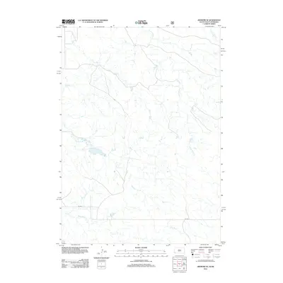
2012 Map of Ardmore SE
USGS Topo · Published 2012About this map
Hay Cr and Mule Cr carve a network of drainage patterns across this stretch of the Nebraska-South Dakota borderlands. This high-plains landscape, documented in 2012, is defined by its seasonal watercourses and the sparse infrastructure of the northern panhandle. The topography is dominated by the intersecting valleys of S Long Hollow Cr and the main Long Hollow Cr branch, which illustrate the subtle but complex erosion of the regional plateau. Human presence is concentrated along the east-west corridor of Co Hwy 5, while smaller tributaries like Short Br Cr further articulate the terrain. This sheet provides a detailed record of the natural drainage systems that have long dictated the placement of ranch roads and boundaries in Bowen Precinct.
Find a feature on this map
6 named features on this map. Tap any name to fly to it.
Don’t see what you’re looking for? This feature index may not catch every label — zoom into the map to look around manually.
Map Details
Editions of this 2012 Ardmore SE Map
This is the sole edition of this map. No revisions or reprints were ever made.
Other maps of this area

1896 · Oelrichs
USGS Topo · 1:125,000

1900 · Oelrichs
USGS Topo · 1:125,000

1902 · Edgemont
USGS Topo · 1:125,000

1950 · Heppner
USGS Topo · 1:24,000

1950 · Rumford
USGS Topo · 1:24,000

1955 · Hot Springs
USGS Topo · 1:250,000

1955 · Alliance
USGS Topo · 1:250,000

1957 · Alliance
USGS Topo · 1:250,000

1958 · Alliance
USGS Topo · 1:250,000

1980 · Montrose
USGS Topo · 1:24,000