
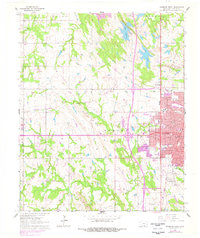
1964 Map of Ardmore West
USGS Topo · Published 1965About this map
Ardmore serves as the focal point of this mid-1960s survey, showing the western expansion of the city across the Gulf Colorado and Santa Fe railroad tracks. The map captures a transition between the dense urban grid—defined by named thoroughfares like Main St and Mc Lish Ave—and the surrounding agricultural landscape. Notable institutional landmarks include the Bloomfield Academy, Lincoln Sch, and the local Courthouse, providing a detailed view of the community's infrastructure before significant modern redevelopment.
Find a feature on this map
76 named features on this map. Tap any name to fly to it.
Don’t see what you’re looking for? This feature index may not catch every label — zoom into the map to look around manually.
Map Details
Editions of this 1964 Ardmore West Map
3 editions found
Other maps of this area

1901 · Ardmore
USGS Topo · 1:125,000

1918 · Ardmore
USGS Topo · 1:125,000

1957 · Ardmore
USGS Topo · 1:250,000

1963 · Ardmore
USGS Topo · 1:250,000

1964 · Lake Murray
USGS Topo · 1:24,000

1964 · Ardmore East
USGS Topo · 1:24,000
1964 · Gene Autry
USGS Topo · 1:24,000

1964 · Overbrook
USGS Topo · 1:24,000

1964 · Springer
USGS Topo · 1:24,000

1969 · Lone Grove
USGS Topo · 1:24,000