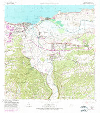
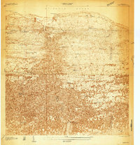
1964 Map of Arecibo
USGS Topo · Published 1990About this map
The Rio Grande de Arecibo carves a deep path through this coastal landscape, meeting the Atlantic Ocean at the city of Arecibo. The 1960s-era topography reveals a region defined by the sugar industry and maritime trade, with Central Cambalache and Central Los Caños serving as major industrial anchors. South of the urban center, the terrain transitions into the limestone haystack hills of Arenalejos and Miraflores, while the eastern coast is dominated by the vast wetlands of the Cienaga Tiburones.
Find a feature on this map
90 named features on this map. Tap any name to fly to it.
Don’t see what you’re looking for? This feature index may not catch every label — zoom into the map to look around manually.
Map Details
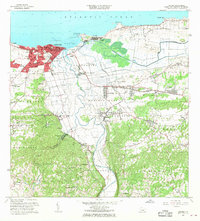
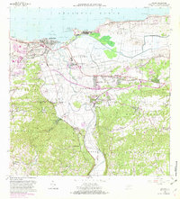
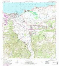
Editions of this 1964 Arecibo Map
4 editions found
Other maps of this area
1938 · Camuy
USGS Topo · 1:20,000

1942 · Arecibo
USGS Topo · 1:30,000
1942 · Camuy
USGS Topo · 1:30,000

1942 · Barceloneta
USGS Topo · 1:30,000

1943 · Utuado NE
USGS Topo · 1:10,000

1946 · Barceloneta
USGS Topo · 1:30,000

1946 · Utuado
USGS Topo · 1:30,000

1946 · Bayaney
USGS Topo · 1:30,000

1946 · Arecibo
USGS Topo · 1:30,000

1946 · Florida
USGS Topo · 1:30,000
Featured Places
- Arecibo, Arecibo
- Reparto Capitolio, Arecibo
- Villa Vélez, Arecibo
- Sector Pueblo de Paja, Arecibo
- Ballajá, Arecibo