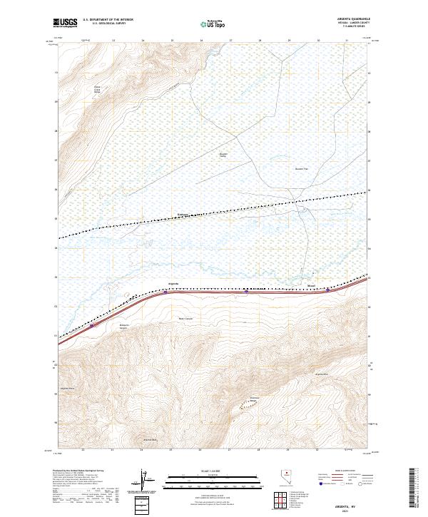
2021 Map of Argenta
USGS Topo · Published 2021About this map
The Humboldt River corridor defines the geography of this central Nevada landscape, where the valley floor transitions into the heights of the Shoshone Range and the Sheep Creek Range. This 2021 survey documents the persistent transportation and settlement patterns of the region, anchored by the community of Argenta and the rail-side locations of Kampos and Mosel. The terrain is marked by significant topographical features including Argenta Rim and Argenta Butte, which rise sharply south of the river.
Find a feature on this map
23 named features on this map. Tap any name to fly to it.
Don’t see what you’re looking for? This feature index may not catch every label — zoom into the map to look around manually.
Map Details
Editions of this 2021 Argenta Map
This is the sole edition of this map. No revisions or reprints were ever made.
Other maps of this area

1955 · Winnemucca
USGS Topo · 1:250,000

1957 · Dunphy
USGS Topo · 1:62,500

1957 · Battle Mountain
USGS Topo · 1:62,500

1958 · Winnemucca
USGS Topo · 1:250,000

1962 · Winnemucca
USGS Topo · 1:250,000

1965 · Sheep Creek Range SW
USGS Topo · 1:24,000

1965 · Sheep Creek Range SE
USGS Topo · 1:24,000
1965 · Izzenhood Spring
USGS Topo · 1:24,000
1985 · The Geysers
USGS Topo · 1:24,000
1985 · Stony Point
USGS Topo · 1:24,000