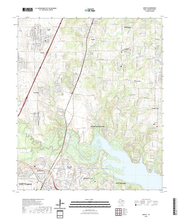
2022 Map of Argyle
USGS Topo · Published 2022About this map
Grapevine Lake dominates the southern landscape of this Denton County quadrangle, where the waters meet the suburban expansion of Flower Mound and Trophy Club. The terrain transitions from the inundated basin of Denton Creek and its many tributaries, like Whites Br and Sharps Br, to the elevated ground of Prairie Mound. These natural rises provided early focal points for the community, evidenced by the Prairie Mound Cem and other family burial sites like Jeter Family Cem and Kelsey Cem.
Find a feature on this map
39 named features on this map. Tap any name to fly to it.
Don’t see what you’re looking for? This feature index may not catch every label — zoom into the map to look around manually.
Map Details
Editions of this 2022 Argyle Map
This is the sole edition of this map. No revisions or reprints were ever made.
Other maps of this area

1894 · Fort Worth
USGS Topo · 1:125,000

1931 · Grapevine
USGS Topo · 1:62,500

1954 · Dallas
USGS Topo · 1:250,000

1954 · Sherman
USGS Topo · 1:250,000

1955 · Keller
USGS Topo · 1:24,000

1955 · Haltom City
USGS Topo · 1:62,500

1958 · Dallas
USGS Topo · 1:250,000

1958 · Sherman
USGS Topo · 1:250,000
1959 · Grapevine
USGS Topo · 1:24,000
1959 · Colleyville
USGS Topo · 1:24,000