Loading...
Loading map...1959 Map of Grapevine
USGS Topo · Published 1960About this map
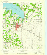
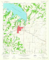
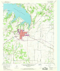
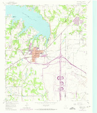
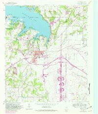
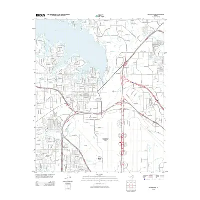
Grapevine Reservoir dominates the northern landscape of this 1959 survey, its winding shoreline cutting through the border of Tarrant and Denton counties. The town of Grapevine sits at a geographic crossroads, where the St Louis Southwestern railroad meets several local loops and regional routes. This era captures the area just before the massive suburban expansion of the late 20th century, showing a landscape still defined by agricultural landmarks and small-town infrastructure.
Find a feature on this map
40 named features on this map. Tap any name to fly to it.
Don’t see what you’re looking for? This feature index may not catch every label — zoom into the map to look around manually.
Map Details
Date Portrayed1959
Date Published1960
PublisherU.S. Geological Survey
Map TypeTopographic
Scale1:24,000
Physical Dimensions23 x 26.9 inches
Editions of this 1959 Grapevine Map
5 editions found
Historical Maps of Irving Through Time
8 maps found


Featured Locations
Source Details
SourceU.S. Geological Survey
CopyrightPublic Domain