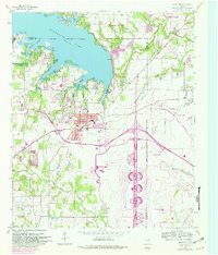
1959 Map of Grapevine
USGS Topo · Published 1982About this map
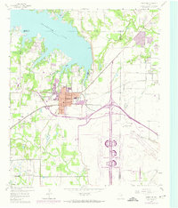
Grapevine Lake dominates the northern landscape of this survey, which captures the North Texas prairie as it began its rapid suburban transformation. The central town of Grapevine is shown at a pivotal moment, with its historic core along Wall St and Nash St transitioning from a rail-oriented agricultural center to a modern hub. The presence of the St Louis Southwestern railroad tracks highlights the town's historical reliance on transit, while the emerging highway network and massive Radio Stations (WFAA & WBAP) facility to the southeast signal the area's growing regional importance.
Find a feature on this map
32 named features on this map. Tap any name to fly to it.
Don’t see what you’re looking for? This feature index may not catch every label — zoom into the map to look around manually.
Map Details
Editions of this 1959 Grapevine Map
5 editions found
Other maps of this area

1891 · Dallas
USGS Topo · 1:125,000

1893 · Dallas
USGS Topo · 1:125,000

1894 · Fort Worth
USGS Topo · 1:125,000

1925 · Mc Kinney 3-c
USGS Topo · 1:48,000

1925 · Dallas 2-b
USGS Topo · 1:48,000

1929 · Frisco
USGS Topo · 1:62,500

1931 · Carrollton
USGS Topo · 1:62,500

1931 · Grapevine
USGS Topo · 1:62,500

1954 · Dallas
USGS Topo · 1:250,000

1954 · Sherman
USGS Topo · 1:250,000