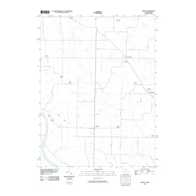
2010 Map of Argyle
USGS Topo · Published 2010About this map
Argyle and Charleston anchor this rural landscape in Lee County, where the topography is defined by the winding course of the Des Moines River and its numerous tributaries. The map documents a deeply established agricultural community, evidenced by the high density of family and community burial grounds including Saint Marys Cemetery, Bowman Cemetery, and Ambrosia Cemetery. These sites, scattered among the drainages of Goose Creek and Sugar Creek, offer significant points of interest for genealogists tracing early families in the region.
Find a feature on this map
43 named features on this map. Tap any name to fly to it.
Don’t see what you’re looking for? This feature index may not catch every label — zoom into the map to look around manually.
Map Details
Editions of this 2010 Argyle Map
This is the sole edition of this map. No revisions or reprints were ever made.
Other maps of this area

1903 · Kahoka
USGS Topo · 1:125,000

1936 · Keokuk
USGS Topo · 1:62,500

1936 · Fort Madison
USGS Topo · 1:62,500

1949 · Wayland
USGS Topo · 1:24,000

1949 · Kahoka
USGS Topo · 1:24,000

1950 · Kahoka
USGS Topo · 1:24,000

1950 · Wayland
USGS Topo · 1:24,000

1950 · Keokuk
USGS Topo · 1:62,500

1958 · Burlington
USGS Topo · 1:250,000

1961 · Burlington
USGS Topo · 1:250,000