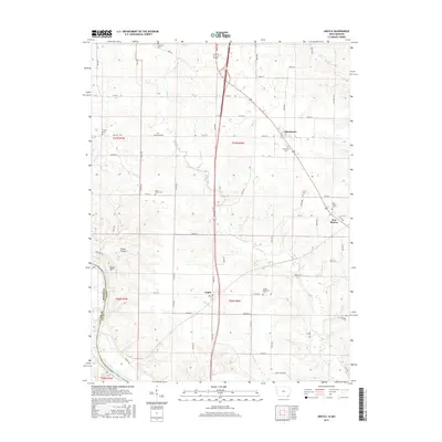
2015 Map of Argyle
USGS Topo · Published 2015About this map
The Des Moines River forms the state line between Iowa and Missouri in the southwestern corner of this Lee County landscape. Small agricultural settlements like Argyle and New Boston sit along the corridors of Highway 218 and 27, surrounded by a network of drainage creeks including Sugar Cr, Goose Cr, and Birch Cr. The map is particularly notable for its density of rural cemeteries, such as Saint Marys Cem and Embury Cem, which often mark the location of early community centers and farmstead clusters.
Find a feature on this map
47 named features on this map. Tap any name to fly to it.
Don’t see what you’re looking for? This feature index may not catch every label — zoom into the map to look around manually.
Map Details
Editions of this 2015 Argyle Map
This is the sole edition of this map. No revisions or reprints were ever made.
Other maps of this area

1903 · Kahoka
USGS Topo · 1:125,000

1936 · Keokuk
USGS Topo · 1:62,500

1936 · Fort Madison
USGS Topo · 1:62,500

1949 · Wayland
USGS Topo · 1:24,000

1949 · Kahoka
USGS Topo · 1:24,000

1950 · Kahoka
USGS Topo · 1:24,000

1950 · Wayland
USGS Topo · 1:24,000

1950 · Keokuk
USGS Topo · 1:62,500

1958 · Burlington
USGS Topo · 1:250,000

1961 · Burlington
USGS Topo · 1:250,000