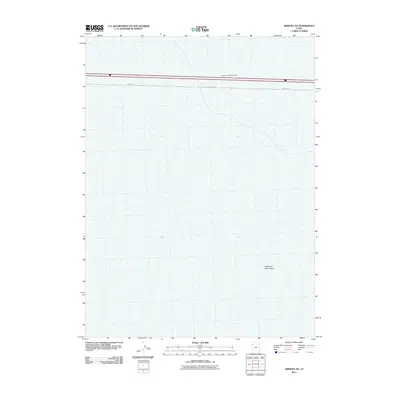
2011 Map of Arinosa NE
USGS Topo · Published 2011About this map
Metaphor: The Tree of Utah, a prominent 87-foot tall sculpture, stands as a singular vertical landmark in this otherwise flat expanse. The surrounding landscape is dominated by the Great Salt Lake Desert, characterized by its vast salt crust and minimal topographic relief. The map illustrates a section of the Interstate 80 corridor, where the sculpture was designed to offer visual interest to travelers crossing the basin. Apart from the highway and the Frontage Rd, the terrain remains largely undeveloped, serving as a stark illustration of the environment in western Tooele County. This survey captures the relationship between modern art and the geographic isolation of the Great Basin during the early 21st century.
Find a feature on this map
3 named features on this map. Tap any name to fly to it.
Don’t see what you’re looking for? This feature index may not catch every label — zoom into the map to look around manually.
Map Details
Editions of this 2011 Arinosa NE Map
This is the sole edition of this map. No revisions or reprints were ever made.
Other maps of this area

1953 · Tooele
USGS Topo · 1:250,000

1955 · Tooele
USGS Topo · 1:250,000

1973 · Knolls SW
USGS Topo · 1:24,000

1973 · Arinosa
USGS Topo · 1:24,000

1973 · Arinosa SE
USGS Topo · 1:24,000

1973 · Floating Island SW
USGS Topo · 1:24,000

1973 · Arinosa SW
USGS Topo · 1:24,000

1973 · Arinosa NE
USGS Topo · 1:24,000

1973 · Floating Island SE
USGS Topo · 1:24,000

1973 · Barro
USGS Topo · 1:24,000